


THE SUNDAY SNAP
The ghostlines of medieval London

We popped down through a layer of chubby white cloud over the English Channel, banked left over Kent and came at London from the east. Fasten seatbelts, get your bags under the seats and gargle the last dregs of your in-flight gin: ladies and gentlemen, we’ll soon be hitting the ground.
No matter where I’ve been, I always love flying in over the UK’s capital city. I’ve lived in or near London for half my life - and I love to see the familiar landmarks given new aspect and positional logic from the sky. Up high is also a great place to make sense of London’s long history. I like this photo - snapped from my window-seat - because buried deep within it is the outline of the medieval city.
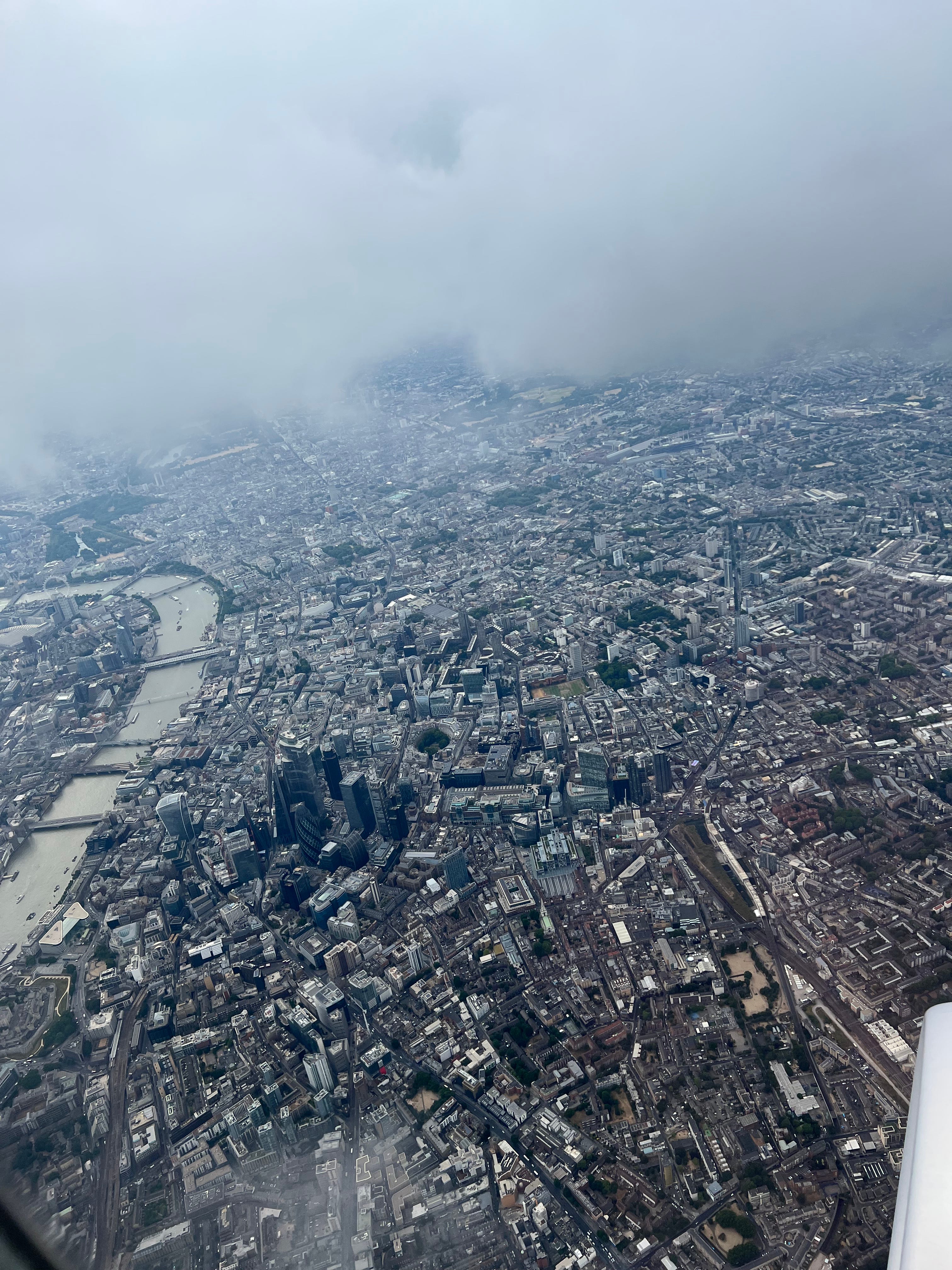
Overlay a rough, imaginary semicircle on this photo, starting at the Tower of London (on the left edge of frame, close the bottom corner), curving round the small cluster skyscrapers and rejoining the river a few millimetres beyond the white dome of St Paul’s Cathedral. (You may need to zoom in to find it.) There you have the old boundary of the city of London in the Middle Ages. Plenty more lay outside - the suburb of Southwark on the south bank of the Thames, the palaces and legal offices around what is now The Strand, and the royal administrative hub at Westminster - but the semicircle you have imagined was the core of it.
Although virtually every medieval building is now gone, some of the old street layout of medieval London is preserved today, which is why the modern city lacks any hint of a grid system, and (partially) why the traffic is always shit. And then, as now, the city and river were indivisible. No Thames, no London. Or not as we know it.
Anyway. I hope you admire the view as much as I did. This week I’ll mostly be in England’s second city, Birmingham, before heading to the book factory on Friday to sign 3,500 copies of Essex Dogs. If you want to pre-order one, now is the time. The special edition (with international delivery) is available via The Broken Binding. The regular edition, currently available at a 50% discount for UK preorders, is available from WH Smith.
I’ll keep you updated, as always.
Enjoy!
Dan
PS one last fun fact about London from above. A few years back I made a TV series called something like London: 2000 Years of History. It was fun to make, and people seemed to like it. But there were a few budgetary issues (normal) and we couldn’t shoot original helicopter or drone footage. Instead, stock footage was bought from a picture library (also normal). However, there must have been a hungover editor on duty one day. When I was watching the show broadcast on TV, I was surprised to see that our ‘top shot’ of London in one episode did have a neat grid system to its streets. It also had two rivers. And…. the Twin Towers! That’s showbiz, as they say. See you round the way.
Looking at places from above like that is pretty great but also not exactly easy to do when you don’t live in a city with a major airport. The next best thing, for me, is going to your local authority’s record office and archives and looking through the old maps. Comparing them with modern OS maps really highlights the continued occupation of the English landscape across hundreds (and thousands) of years.
When you grow up in a city of the New World, it's disconcerting to be a pedestrian in any european city. I got lost several times in those primitive and happy times before GPS.